AESA Launches Updated Wildlife Risk Map for Pilots and Airports
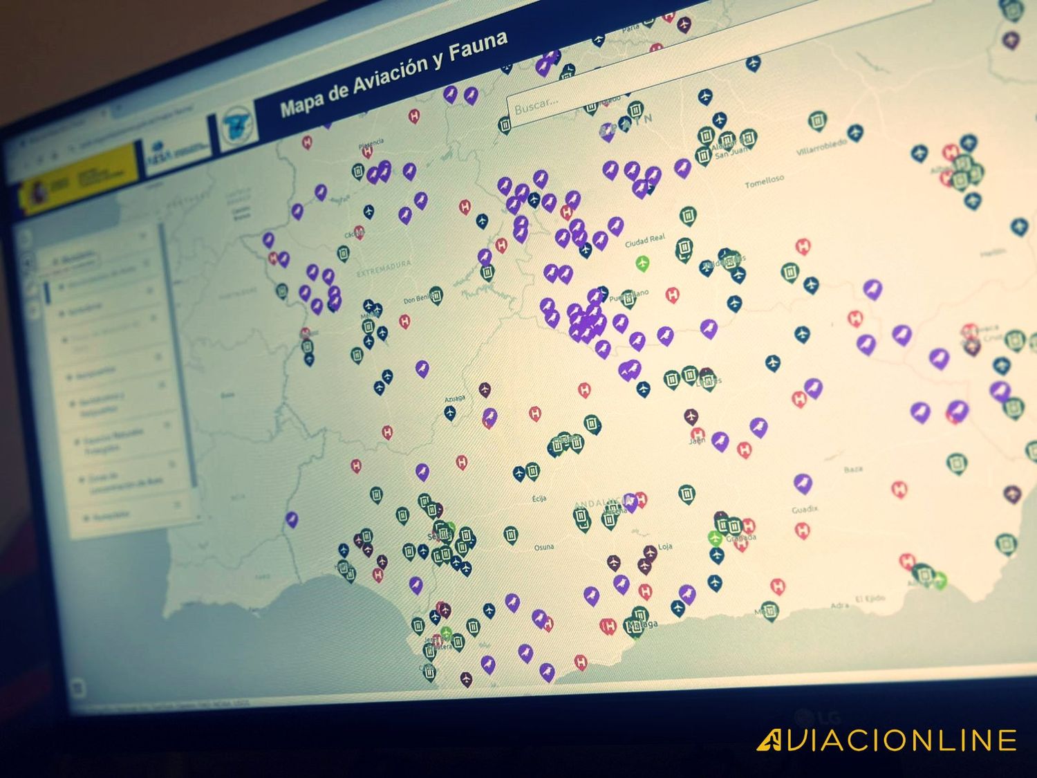
The Spanish Aviation Safety Agency (AESA) (Spanish), has released an updated version of its Aviation and Wildlife Map, a digital tool designed to identify areas of potential risk due to the presence of wildlife in aviation operations. According to the agency, this new version incorporates more comprehensive data and advanced functionalities aimed at meeting the sector’s needs and expanding its user base.
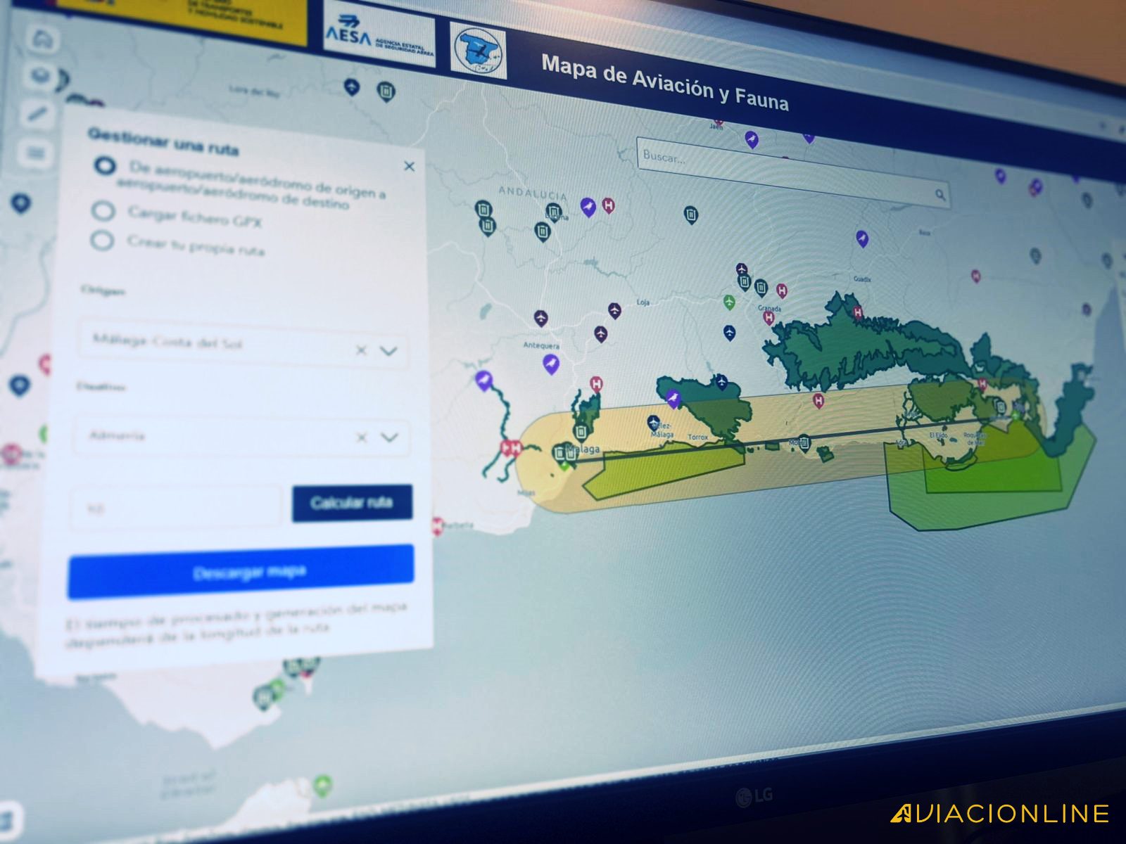
Among the main improvements is the ability to plan flight routes while considering critical wildlife attraction areas. AESA highlights that this functionality allows users to anticipate areas prone to animal concentrations, especially birds, which could pose risks to aviation. Additionally, new layers of environmental information have been added, such as the locations of authorized landfills, wetlands, and the Natura 2000 Network, as well as updated data on public and restricted-use airfields across the country.
The new GIS viewer, based on ESRI technology, enhances the representation and customization of geographic information layers. Users can toggle between different visualizations, export data in formats such as PDF, and upload routes via GPS files, increasing the tool’s versatility.
According to the agency, the development of this new version was made possible through collaboration between AESA, the Ministry for Ecological Transition and the Demographic Challenge, airport managers, and regional governments. This joint effort allowed for the inclusion of information on feeding stations, bird concentration areas, and other wildlife attraction hotspots in airport environments.
AESA emphasizes that this version significantly improves upon the limitations of the previous system, which focused solely on public-use commercial airports and offered limited data. With the update, the map now covers all national airfields and provides more detailed information about wildlife species relevant to aviation operations and their movements.
With these innovations, AESA aims to enhance the operational safety of civil aviation, providing pilots and users in both commercial and general aviation sectors with a more robust and tailored tool. According to the agency, these improvements not only increase precision in flight planning but also strengthen risk prevention related to wildlife.
The new version of the Aviation and Wildlife Map (Spanish), is now available on the AESA website, where users can access all its functionalities.
Responsable English Feed en Aviacionline. Reportero gráfico.
Para comentar, debés estar registradoPor favor, iniciá sesión